

Temporary danger area
ESD89X Farsta UAS
Airspace information for Everdrone’s beyond visual line of sight (BVLOS) operations in ESD891/ESU251 Farsta, ESD892/ESU252 Bollmora, ESD893/ESU253 Skogås, ESD894/ESU254 Vega and ESD895/ESU255 Sjödalen, carried out upon request from SOS Alarm 112 and Region Stockholm.
Active
Daily 08:00 to 22:30 LT
Vertical limits
GND to 600 ft AMSL
Normal operating height
30 to 80 m AGL
Urgent, while the area is active
+46 766 86 04 14Pilot in command. Secondary number +46 31 799 29 14. For non-urgent matters, contact Everdrone OPS on +46 31 799 29 14 or operations@everdrone.com during office hours.
Manned aircraft
Coordinate before you fly through the area
Operators of manned aircraft are encouraged to contact Everdrone for airspace coordination if a planned flight may conflict with operations in the danger area.
Drone operators (UAS)
Danger zone 30 to 80 m AGL
- Flights below 30 m or above 80 m AGL may generally be considered safe when flown within visual line of sight (VLOS) with continuous, close monitoring of the aircraft and its surroundings.
- Flights within the danger zone should be flown within VLOS with continuous, close monitoring. Be prepared to leave the area immediately to avoid a collision.
- Operators who can follow these precautions do not need to contact Everdrone first. If you cannot, contact Everdrone.
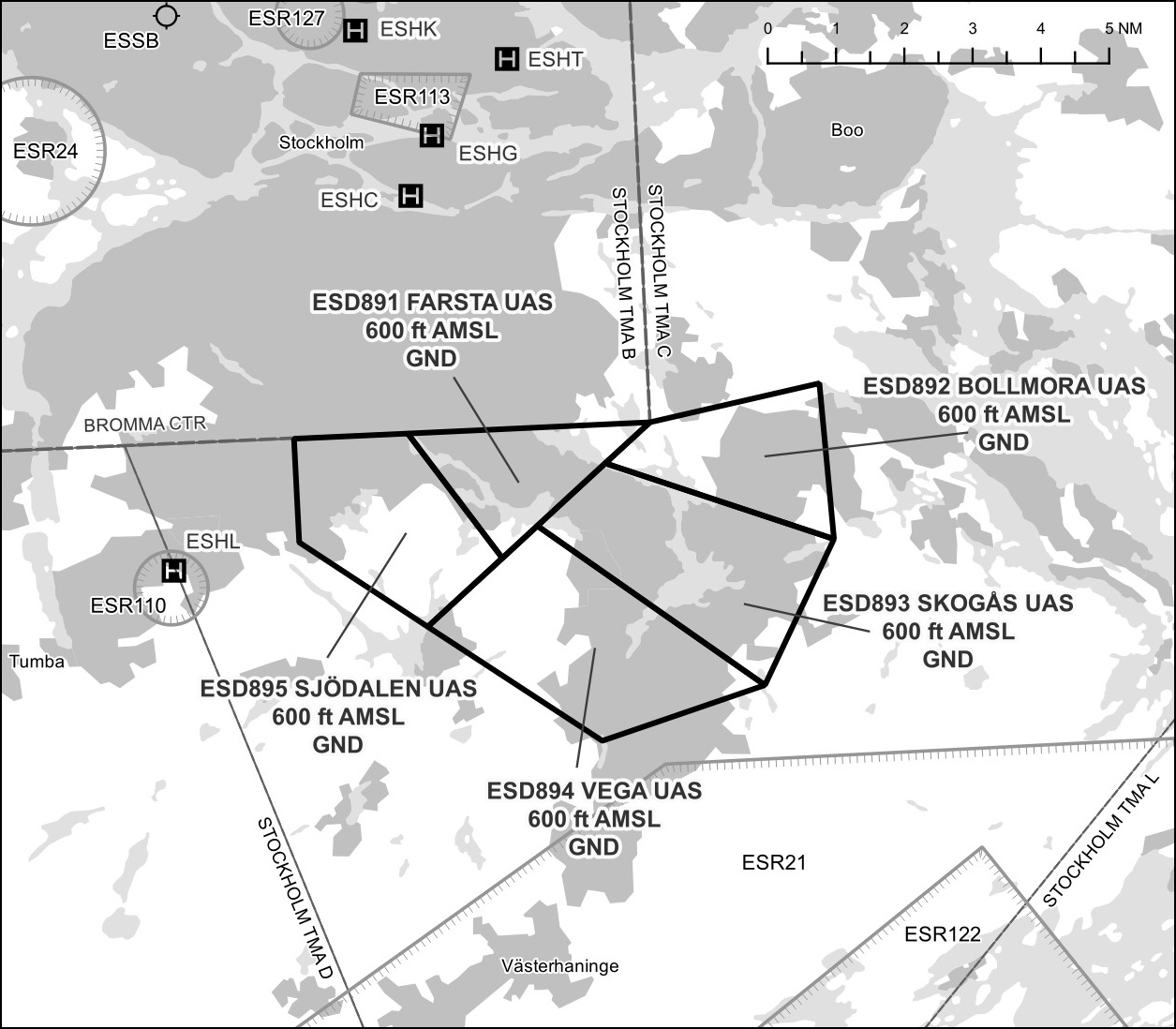
map
Reference
AIP Supplement 125/2026
Danger areas ESD891 to ESD895 (vertical limit GND to 600 ft AMSL) overlap with geographical UAS zones ESU251 to ESU255 (vertical limit GND to 150 m AGL). They are established for DEMS operations beyond visual line of sight, carried out upon request from SOS Alarm 112 and Region Stockholm. During active hours, the aircraft may be dispatched with 15 seconds notice to anywhere within the area.
View the AIP Supplement at aro.lfv.se →Safety notice
A collision within the area could cause personal injury and property damage, and may delay or prevent time-critical emergency operations. All UAS operations within the danger area are undertaken at the operator’s own risk.